
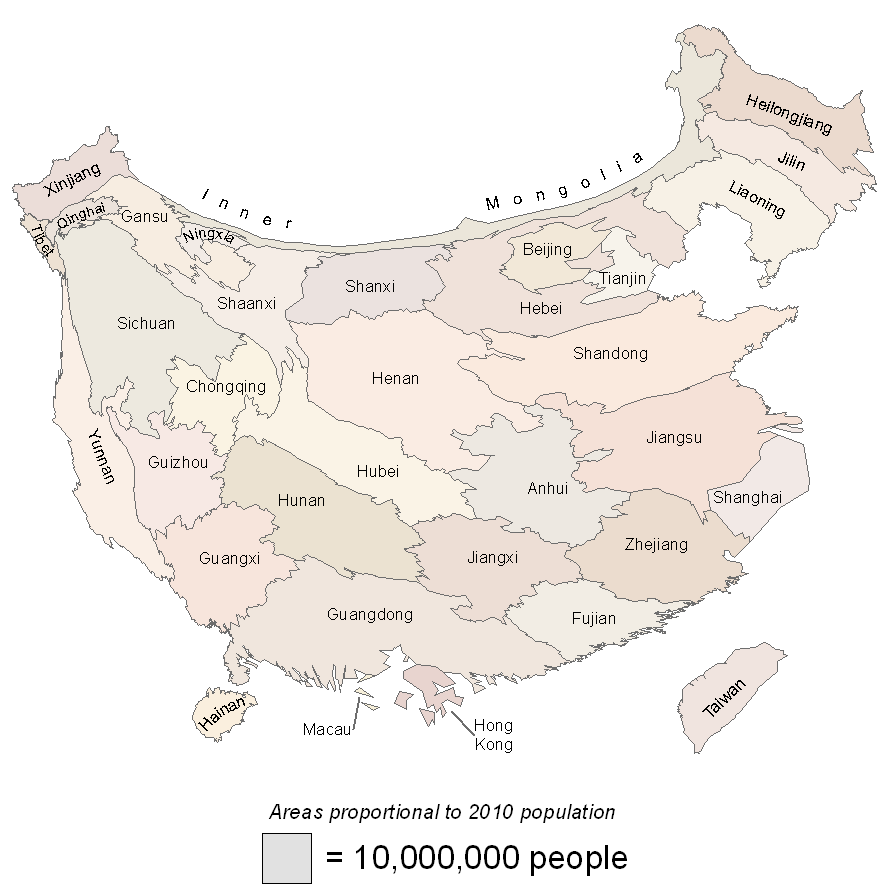
China 2010 population
Illinois 2016 presidential election results by county

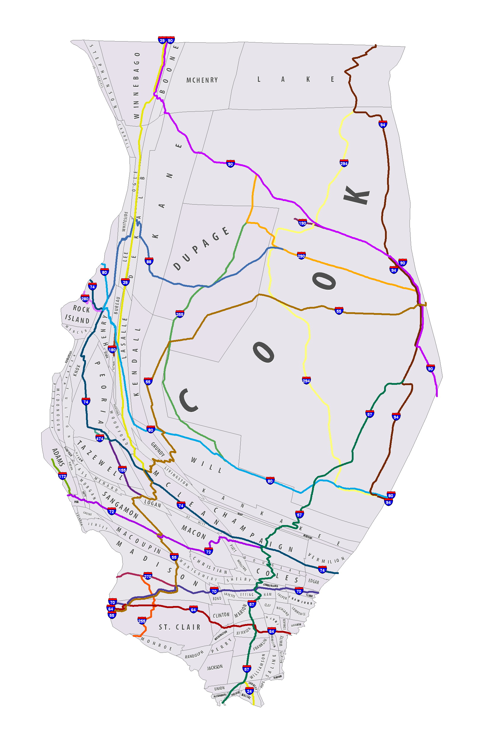
Illinois 2010 county population cartogram with highways and labels
Cartogram Studio is a free portable Windows application for manually constructing continuous cartograms. If you are looking for a quick and easy way to create cartograms, you are encouraged to check out algorithm-based tools such as the following:
Unlike these tools, Cartogram Studio does not create a cartogram for you. Instead, it provides tools for modifying the shape of map polygons while visually displaying size objectives. This gives you precise control over the form of the final cartogram. See the gallery for examples of cartograms created with Cartogram Studio.
Algorithms for cartogram construction exist, but many people find the maps created by these algorithms to be jarring. Cartogram Studio provides cartographers with full control over the shape of the cartogram. Furthermore, unlike block cartograms, the result is continuous cartogram with all topological relationships guaranteed to be preserved.
A YouTube video showing the basic steps to producing a cartogram is linked to on the Download page.
To ensure responsiveness and eliminate tedious manual labor, Cartogram Studio requires simplified datasets and matched cartogram files. Unfortunately, tools for creating these are not yet ready for public release. Therefore, at this time the software can only be used with the datasets provided on this website.
The original implementation framework for Cartogram Studio is described in a 2016 article published in Cartography and Geographic Information Science. A post-print is available here.
Major updates to the framework were implemented in 2018. Please contact me if you would like more information.
Cartogram Studio is a project of Dr. Barry Kronenfeld, Associate Professor of GIS & Cartography at Eastern Illinois University (EIU). Development was supported in part through two EIU Council on Faculty Research (CFR) grants awarded in 2015 and 2018.
Yes, for educational or research purposes.
Cartogram Studio is licensed under a Creative Commons Attribution-NonCommercial-ShareAlike 4.0 International license (CC BY-NC-SA 4.0). You are free to use and share the software for educational or research purposes, so long as you provide attribution.
Not at this time.
Maybe!
The long-term objective of the Cartogram Studio project is to become a hub for free and possibly open-source software tools, cartogram construction base files, cartogram data and maps. The funding model will be to solicit small contributions and grants to support development of individual datasets, and larger contributions and grants to improve the software, provide documentation and move it towards open source.
Since cartograms are very much a "niche" map form, it is expected that interest, and therefore progress, will be slow. However, any support is appreciated, no matter how small! If you want to support the goal of free and open tools and data for cartogram construction, or if you have a particular project you would like to collaborate on, please contact me to discuss.